Photo: Alan O'Dowd / Wikimedia Commons / CC BY-SA 2.0 — Source
The Making of the Forth Valley: Fire, Ice and Ten Thousand Years of Human History
From volcanic eruptions to glacial sculpting, from Mesolithic whale hunters to 18th-century peat clearers — how the Forth Valley landscape was formed and transformed over millennia.
Introduction
Stand on the battlements of Stirling Castle and look out across the broad, flat plain of the Carse of Stirling. To the north, the Ochil Hills rise abruptly. To the west, the Gargunnock and Touch Hills frame the horizon. Below, the River Forth winds in extravagant loops through rich farmland that was, not so very long ago, the floor of an inland sea. This landscape is the product of forces almost unimaginable in scale — volcanic eruptions, tectonic collisions, ice sheets a mile thick, and the slow rise and fall of the sea itself. Every feature tells a story. The rock beneath Stirling Castle is a remnant of molten magma that forced its way between layers of ancient sediment over 300 million years ago. The flat carse lands are the silted-up bed of a post-glacial estuary. And the great raised bogs of Flanders Moss preserve, in their peat, a record of environmental change stretching back eight millennia. This article traces the making of the Forth Valley — from the geological deep time that created its bones, through the Ice Age that sculpted its modern form, to the ten thousand years of human habitation that have shaped and reshaped the landscape we see today.The Bones of the Valley: Volcanic Origins
The story begins around 400 million years ago, when the collision of two tectonic plates threw up the Scottish Highlands along a great boundary fault — the Highland Boundary Fault — that runs from Helensburgh to Stonehaven. The Forth Valley sits immediately south of this line, in a rift valley that dropped three to five kilometres below the Highland massif. This geological accident — placing Stirling at the very hinge between Highlands and Lowlands — would determine the region’s strategic importance for all of recorded history. Around 300–350 million years ago, during the Carboniferous period, volcanic activity produced the hard igneous rocks that would later become the valley’s most prominent landmarks. Stirling Castle sits on an outcrop of quartz-dolerite, part of the Stirling Sill — a sheet of magma that intruded horizontally into surrounding sedimentary rocks. Abbey Craig, on which the Wallace Monument stands, is a volcanic plug of similarly resistant rock. Craigforth, between Stirling and Bridge of Allan, is another.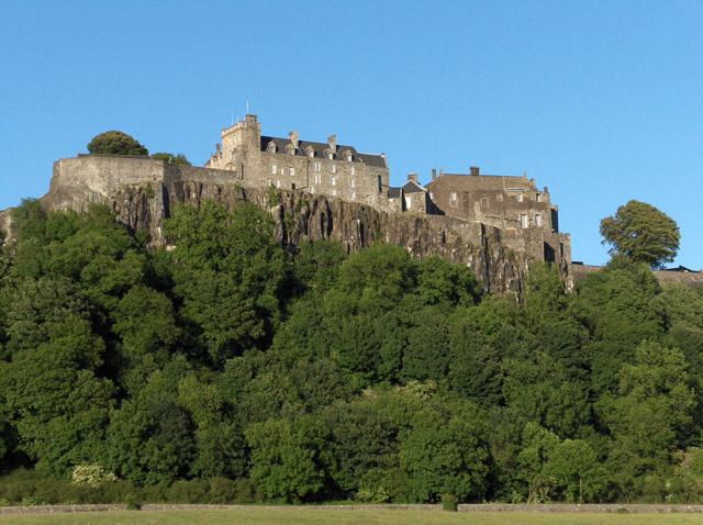
Photo: Andrew Smith / Wikimedia Commons / CC BY-SA 2.0 — Source
Stirling Castle on its volcanic crag, with the Carse of Stirling stretching beyond. View on Wikimedia Commons · Photo: Thomas Nugent / CC BY-SA 2.0The southern boundary of the valley — the Touch Hills, Gargunnock Hills, Fintry Hills and Campsie Fells — were formed by later volcanic upheavals, also during the Carboniferous. These uplands, together with the Ochils to the north-east, created the natural amphitheatre of the Forth Valley, funnelling drainage towards the single narrow gap at Stirling where the river passes between Castle Rock and Abbey Craig.
The Great Ice Age: Sculpting the Landscape
For most of the last two million years, Scotland was periodically buried beneath ice sheets of enormous thickness. At their maximum extent, around 22,000 years ago, ice lay to a depth of some 1,500 metres (5,000 feet) over the Highlands north-west of Stirling. Sea levels were far lower than today — so much of the world’s water was locked up in glaciers that Britain was connected to continental Europe by a land bridge. As the ice moved eastward through the Forth Valley towards the North Sea, it sculpted the landscape we recognise today. The hard volcanic plugs resisted erosion, while softer sedimentary rocks were gouged away around them. The result was a series of classic crag-and-tail landforms: a steep, resistant crag on the west (facing the oncoming ice) with a tapering ramp of glacial debris — the ‘tail’ — trailing eastward in the ice’s wake.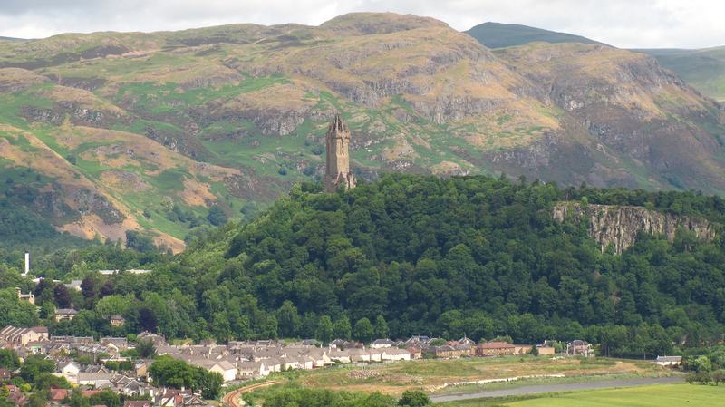
Photo: Janfrie1988 / Wikimedia Commons / Public Domain — Source
Abbey Craig, a volcanic plug shaped by glaciation into a classic crag-and-tail formation. View on Wikimedia Commons · Photo: Finlay McWalter / CC BY-SA 3.0Stirling Castle Rock is the finest example: a near-vertical cliff on its western face, with the Old Town of Stirling built along the gentle eastward slope of its tail. Abbey Craig displays the same pattern. Edinburgh Castle Rock is another famous example of the same glacial process, its tail forming the Royal Mile. The last major glacial advance, the Loch Lomond Stadial (approximately 12,900–11,500 years ago), pushed ice back into the western Forth Valley as far as Callander and the Lake of Menteith. This brief, fierce cold snap deposited further layers of till and gravel before the climate warmed decisively and the ice retreated for the last time.
When the Sea Came In: The Flandrian Transgression
As the ice melted, two competing processes transformed the Forth Valley. The melting glaciers released vast quantities of water, raising global sea levels. But the land itself, freed from the immense weight of ice, also began to rise — a process called isostatic rebound that continues very slowly to this day. For several millennia, the sea rose faster than the land. The result was the Flandrian transgression: salt water flooded deep into the Forth Valley, transforming it into a broad tidal estuary — effectively a sea loch — penetrating as far inland as Aberfoyle. At its maximum, around 6,500 years ago, relative sea level stood approximately 16 metres above today’s level in the Aberfoyle area. The ground on which Stirling city centre now stands was underwater.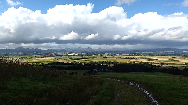
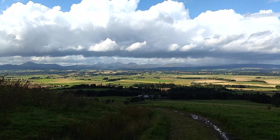
Photo: Alan O'Dowd / Wikimedia Commons / CC BY-SA 2.0 — Source
The flat Carse of Stirling, former floor of a post-glacial estuary, seen from the Touch Hills. View on Wikimedia Commons · Photo: Andrew Smith / CC BY-SA 2.0Whales swam in this estuary. Their skeletons have been found buried in the carse clay deposits at several locations west of Stirling. In 1877, workmen digging a drain at Meiklewood, near Gargunnock, uncovered the skull and bones of a rorqual whale — alongside a Mesolithic antler-beam mattock, one of the most important prehistoric artefacts ever found in the Forth Valley. This remarkable find, now dated to approximately 3,900 BC, shows that people were already living and working alongside the retreating shoreline. As the land continued to rebound, the sea gradually withdrew eastward. It left behind thick deposits of marine clay, silt and shells — the fertile carse soils that make the Forth Valley one of Scotland’s finest agricultural areas today. The old shorelines are still visible as raised beaches: subtle terraces in the landscape, sometimes identifiable by a change in vegetation or a line of slightly higher ground.
Flanders Moss: The Great Bog
As the estuary silted up and the sea retreated, the poorly drained flats of the upper Forth Valley became waterlogged. Over thousands of years, Sphagnum moss colonised these wetlands, building layer upon layer of dead plant material that compressed into peat. The result was Flanders Moss, one of the largest raised bogs in Britain, stretching across the Carse west of Stirling.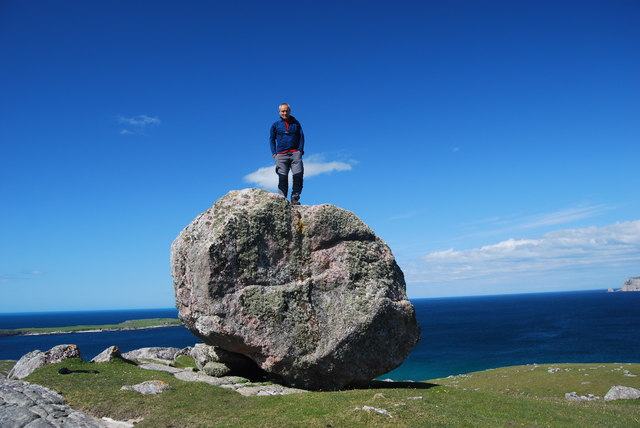
Photo: John Chroston / Wikimedia Commons / CC BY-SA 2.0 — Source
A glacial erratic boulder, carried and deposited by ice sheets — features like these are found scattered across the Forth Valley landscape. View on Wikimedia Commons · Photo: Alan Reid / CC BY-SA 2.0At its greatest extent, the moss covered thousands of acres and formed a formidable barrier to north–south travel. Military commanders learned this to their cost: the bog made the Forth crossing at Stirling even more critical, since it was practically impossible to outflank the bridge by marching through the waterlogged carse lands on either side. Today, Flanders Moss is a National Nature Reserve managed by NatureScot. It preserves a unique record of environmental change: pollen grains trapped in successive layers of peat reveal the shifting patterns of vegetation over eight millennia — from birch and hazel woodland to open farmland and back again. Nearby, the Lake of Menteith — often called the only natural lake in lowland Scotland — occupies a hollow scooped out by the same glaciers. The name ‘Lake’ rather than ‘Loch’ may derive from a misreading of ‘laich’ (Scots for ‘low-lying land’) by 19th-century Ordnance Survey cartographers.
The First People: Mesolithic Hunter-Gatherers
Humans arrived in the Forth Valley not long after the ice retreated. By around 8,000 BC, small bands of Mesolithic hunter-gatherers were moving through the landscape, exploiting the rich resources of the estuary, the forests and the uplands. They hunted red deer and wild boar, gathered hazelnuts and berries, fished in the river and the sea, and collected shellfish along the retreating shoreline. The evidence is sparse but evocative. The Meiklewood antler mattock, found with the whale skeleton in 1877, is a heavy tool fashioned from the beam of a red deer antler — probably used for digging or chopping. Other antler tools and a smoothed whale rib have been found in the carse clays at Cornton Brickworks, near Bridge of Allan. These artefacts tell us that Mesolithic people were working the shores of the estuary, perhaps butchering stranded whales for their meat and blubber.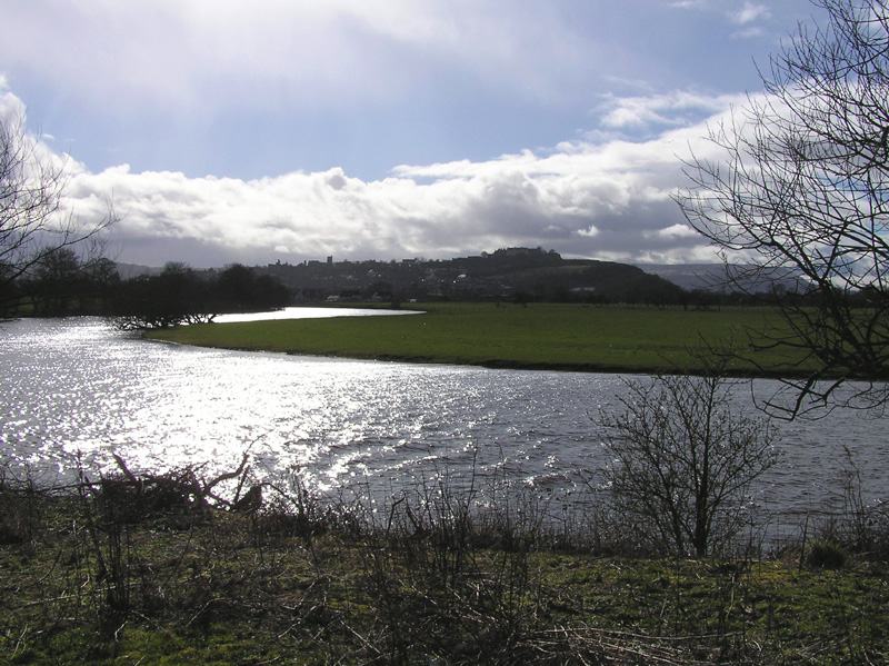
Photo: User Finlay McWalter on en.wikipedia / Wikimedia Commons / CC BY-SA 3.0 — Source
The River Forth winding through the Carse of Stirling in its characteristic meanders. View on Wikimedia Commons · Photo: Andrew Smith / CC BY-SA 2.0Recent excavations at Echline Fields, near South Queensferry, have revealed a sunken-floored Mesolithic structure dated to approximately 8,300 BC — one of the earliest known buildings in Scotland. These discoveries are changing our understanding of Mesolithic life: far from being purely nomadic, some communities returned to favoured locations season after season, building semi-permanent camps beside the Forth.
Farmers and Monument Builders: The Neolithic and Bronze Age
Around 4,000 BC, a revolution swept through the Forth Valley. Farming arrived — probably brought by migrants from continental Europe along with new technologies, new crops and new animals. For the first time, people began to clear the forest, till the soil and keep livestock. The pollen record from Flanders Moss shows a sharp decline in tree pollen and a corresponding rise in grasses and cereals from this period. The Neolithic and Bronze Age communities left their mark on the landscape in the form of standing stones, cairns and stone circles. The cup-marked rocks at Leckie, near Gargunnock, bear carvings that may date to the Neolithic or Early Bronze Age. Similar cup-and-ring marks are found across the Forth Valley and the wider Scottish landscape, though their meaning remains debated.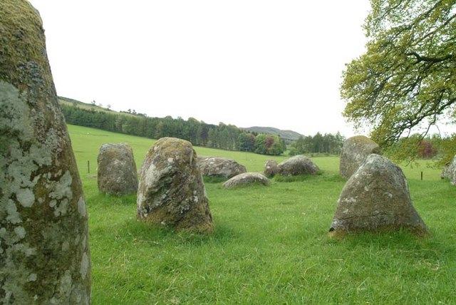
Photo: Dave Farmer / Wikimedia Commons / CC BY-SA 2.0 — Source
A Neolithic stone circle in the Scottish landscape — similar monuments once stood across the Forth Valley. View on Wikimedia Commons · Photo: Dave Fergusson / CC BY-SA 2.0Bronze Age communities (from around 2,000 BC) developed increasingly sophisticated metalworking techniques and traded across wide networks. Cist burials — stone-lined graves containing grave goods of pottery, bronze and jet — have been found at various sites in the Stirling area. The Society holds archive records of several such discoveries.
Hillforts and Brochs: The Iron Age Forth Valley
By the first millennium BC, the Forth Valley was a densely settled landscape. Iron Age communities built hillforts on the commanding heights around the valley — at Dumyat in the western Ochils, at Myot Hill near Denny, and on Abbey Craig itself. These were not simply defensive positions: they were places of power, display and community gathering. Dumyat, whose name probably derives from ‘Dún of the Maeatae’ (the Iron Age tribal confederation that occupied the region), is perhaps the most significant. Recent work by Professor Gordon Noble of Aberdeen University has demonstrated occupation from around 500 BC to 700 AD — over a thousand years. The fort sits on a spur commanding panoramic views across the Carse, and its multiple phases of rampart construction speak to centuries of use and rebuilding. One of the most remarkable Iron Age sites in the valley is the Leckie Broch, near Gargunnock (Canmore site 45379). Brochs — massive drystone towers unique to Scotland — are overwhelmingly a northern and western phenomenon, so finding one in the Forth Valley is exceptional. Excavated between 1970 and 1978, Leckie produced Roman Samian pottery with makers’ stamps, bronze brooches and glass armlets, suggesting that its builders were people of wealth and status — perhaps allies of Rome.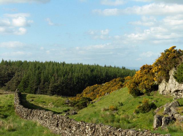
Photo: Andrew Smith / Wikimedia Commons / CC BY-SA 2.0 — Source
The Touch Hills, part of the volcanic uplands framing the southern edge of the Forth Valley. View on Wikimedia Commons · Photo: Robert Murray / CC BY-SA 2.0
The Strategic Crossing: Why Stirling Matters
Geography made Stirling the most important place in Scotland. The volcanic crag provided an impregnable fortress. The impassable bogs of Flanders Moss blocked movement to the west. And the tidal, meandering Forth was uncrossable for miles in either direction. The result was a natural bottleneck: whoever held Stirling controlled the only practical route between Lowland and Highland Scotland. The Romans recognised this when they built the fort at Camelon, near Falkirk, and drove the Antonine Wall across the valley in the 140s AD. Medieval armies fought repeatedly for control of Stirling Bridge and the castle. The Battles of Stirling Bridge (1297) and Bannockburn (1314) were both, fundamentally, struggles over this single geographical chokepoint. But the landscape that made Stirling strategically vital also shaped the everyday lives of its people. The raised ground around the castle and the volcanic outcrops provided dry sites for settlement. The carse lands — too wet to build on but extraordinarily fertile once drained — offered abundant grazing and, eventually, some of the finest arable land in Scotland.Transforming the Carse: The Age of Improvement
For centuries, the flat carse lands west of Stirling were largely uninhabitable — a vast expanse of waterlogged peat bog, treacherous underfoot and useless for farming. The transformation began in 1766, when Lord Kames (Henry Home, the Enlightenment philosopher and judge) inherited the Blair Drummond estate and found that over 1,500 acres of the Moss of Kincardine lay within its bounds. Kames devised an ingenious scheme. He built a waterwheel and drainage channel that diverted water from the River Teith to float the unwanted peat downstream into the Forth. Tenants were offered affordable 38-year leases on plots of eight Scots acres, on condition that they cleared the peat down to the fertile carse clay beneath. The first tenant arrived in 1768.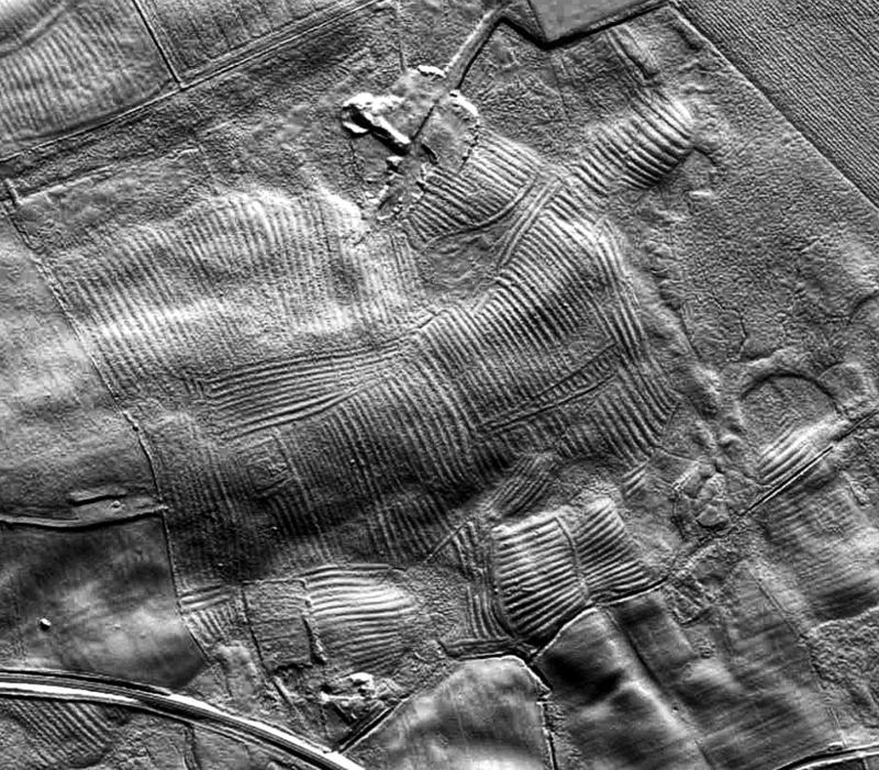
Photo: Dr John Wells / Wikimedia Commons / CC BY 4.0 — Source
LiDAR image revealing medieval rig-and-furrow cultivation patterns — evidence of how earlier generations farmed the landscape. View on Wikimedia Commons · Image: Dr John Wells / CC BY 4.0The scheme continued for nearly a century, until 1865. By 1811, some 764 men, women and children — the ‘Moss Lairds’ — were living on the reclaimed land with their livestock. The environmental cost was significant: peat washed downstream silted up the Forth at Stirling, preventing ships from reaching the town. But the result was some of the most productive farmland in central Scotland, and the site of what is now Blair Drummond Safari Park. Similar improvement schemes transformed the carse lands around Stirling throughout the 18th and 19th centuries. Drainage ditches were cut, fields levelled, and the landscape was gradually converted from wetland to the patchwork of arable and pastoral farmland we see today.
The Wandering River
The River Forth itself is one of the most distinctive features of the valley. Rising on the slopes of Ben Lomond and flowing eastward to the North Sea, it crosses the flat carse lands in a series of extraordinary meanders — wide, looping bends that dramatically increase the river’s length. A straight-line distance of a few miles between two points may involve fifteen or twenty miles of river. These meanders developed because the river crosses an almost perfectly flat surface — the old estuary floor — with very little gradient. With nowhere to flow quickly, the water wanders back and forth, constantly eroding the outer bank of each bend and depositing silt on the inner. Over centuries, some meanders have been cut off entirely, leaving ‘oxbow’ lakes and old channels visible as depressions in the fields. The tidal reach of the Forth extends well above Stirling. Before the medieval bridge was built, the lowest reliable crossing point was at the ford near Drip, where the river could be waded at low tide. A Roman road may have crossed here — timber remains discovered in 2023 are still under investigation — and the spot remained strategically important throughout the medieval period.The Forth Valley Today
Stand again on the castle battlements and look out with new eyes. The flat carse is the floor of a vanished sea. The dramatic crags are volcanic intrusions shaped by ice. The meanders of the Forth trace the river’s slow wandering across a surface that was, 6,500 years ago, tidal mudflat. The rich farmland was won from peat bog by generations of backbreaking labour. And somewhere beneath the carse clay lie the bones of whales that swam here when the valley was an arm of the sea.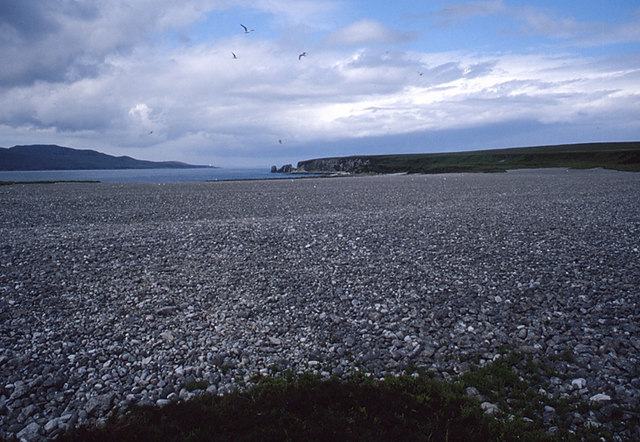
Photo: Tom Richardson / Wikimedia Commons / CC BY-SA 2.0 — Source
A raised beach on the Scottish coast — similar raised shorelines in the Forth Valley mark where the post-glacial sea once reached. View on Wikimedia Commons · Photo: Andrew Smith / CC BY-SA 2.0The Forth Valley landscape is not a finished thing. The land is still rising, very slowly, in response to the removal of the ice. The river is still shifting its course. Climate change is altering the ecology of Flanders Moss and the surrounding farmland. And every year, archaeologists uncover new evidence of the people who lived, hunted and farmed here over the last ten thousand years.
Timeline: The Forth Valley Through Deep Time
- ~400 million years ago — Highland Boundary Fault forms, creating the rift valley
- ~300–350 million years ago — Volcanic intrusions create Castle Rock, Abbey Craig and other hard outcrops
- ~22,000 years ago — Ice sheets at maximum extent; ice over a mile thick above the Highlands
- ~12,900–11,500 years ago — Loch Lomond Stadial: final glacial advance reaches Callander and Lake of Menteith
- ~8,000 years ago — Post-glacial sea begins flooding into the Forth Valley (Flandrian transgression)
- ~6,500 years ago — Sea level peaks at ~16m above modern levels; whales swim in the estuary
- ~3,900 BC — Meiklewood antler mattock deposited alongside whale bones
- ~4,000 BC — Farming arrives; forest clearance begins
- ~2,000 BC — Bronze Age communities build cairns and cist burials
- ~500 BC onward — Iron Age hillforts at Dumyat, Abbey Craig, Myot Hill
- 1st–2nd century AD — Leckie Broch built and occupied; Roman presence at Camelon
- 1297 & 1314 — Battles of Stirling Bridge and Bannockburn
- 1766–1865 — Blair Drummond peat clearance transforms the Moss of Kincardine into farmland
Sources and Further Reading
- British Geological Survey, Geology of the Stirling District (Sheet 39)
- Scottish Archaeological Research Framework (ScARF), South-East Scotland regional framework
- The Carse of Stirling Partnership, History of the Carse
- Scottish Geology Trust, Flanders Moss geological guide
- Canmore (Historic Environment Scotland), Leckie Broch, site 45379
- Canmore, Meiklewood, site 46079
- Canmore, Dumyat, site 47117
- SFAS Interactive Archaeological Map — explore sites mentioned in this article