Photo: Dr John Wells / Wikimedia Commons / CC BY 4.0 — Source
Map
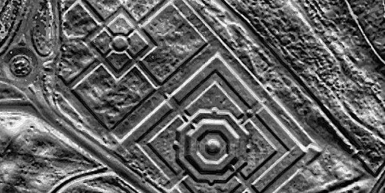
Ordnance Survey Map of Stirling, 1899
First edition 25-inch Ordnance Survey map covering the old town of Stirling, annotated by a Society member to mark the locations of archaeological finds reported to the Society.
Provenance
Society collection.
Rights
Crown copyright expired. Annotations copyright SFAS.